Take Me to the River: Our Water Filtration System

There are glamorous hikers on the trail who stride up to a river with empty Gatorade bottle in hand, stoop down, dunk their bottle in, scoop it out, and take a nice long swig of that crystal clear mountain spring aqua.  It is extremely refreshing to glimpse, especially in comparison to the hikers on the other end of the spectrum struggling over their water pump, working up a sweat for a few little droplets of filtered water.

As much as we’d love  to fall under the former category, we’re afraid of giardia, simply put. We like to treat our water. Luckily, we don’t have to struggle over a water pump or deal with the foul taste of iodine tablets either. We have the Sawyer 3-Way Inline Filter, and it’s almost as easy as dipping our bottle into the river and drinking away….Almost.

Here’s how we treat our water:

1. After purchasing the Inline Filter, cut bladder hose in half. Plug filter into the two ends in the hose, ensuring the filtered end flows towards your mouth.

IMG_5132

2. Fill bladder with untreated water.

Image

IMG_5131


3. Drink out of hose.

IMG_5133

Wow, that was crazy-easy!

But what happens when you want to drink something other than water?…Like coffee, hot chocolate or a powdered juice drink? …When you want a bottle of treated water than you don’t need to drink out of a hose?

Paul fashioned a great system for having a ready supply of treated water, without us having to work for it.  First, he drilled a hole into the lid of his Platypus water bottle. Then he put a small piece of hose into the lid, and attached the bladder full of untreated water to the lid via the filter.

IMG_4067

Finally, he strung up the system to a tree so that it would drip into the bottle while we set up the tent or did other camping chores.

IMG_5407

IMG_4788 IMG_4291

Now we always have a bottle of treated water to use for cooking or making coffee.

IMG_4466

If that bottle gets empty, and we want some water without having to drink it through a hose, we can always do it the old fashioned way: Just take off the mouthpiece portion of the hose and squeeze the untreated water through the filter into the bottle or pot. It just takes a while to do this.

IMG_4898

A tip: Our favorite powdered juice is Crystal Light Raspberry mixed with Tang…So good! It tastes like a Sobe, if you’ve ever had one of those. 😉

For coffee, Paul bought a small MSR coffee filter from REI, and pours hot water through the grounds into his mug. Always a nice way to start the hike.

IMG_4802 IMG_4804 IMG_4807

Katherine prefers hot chocolate with tons of marshmallows (Swiss Miss is tastier than Nestle). Even through a mosquito headnet.

IMG_4810IMG_4811

The Sawyer Inline Filter is guaranteed to work for 1,000,000 gallons, or something insane like that, and cleaning the filter is very easy. Simple unplug the filter from the hose, and run clean tap water through it backwards. In 6 weeks on the trail, we’ve cleaned our filters twice.

IMG_5227


Leaving Tuolumne Meadows: The Water Chapter

Tuolumne Meadows is a lot of fun; compact, full service, and near a nice campground. There is a great little Store at which to resupply, and the staff at the Post Office are really cool and friendly.
image

We stayed one night at the Tuolumne Meadows campground, and ate at the grill, which is attached to the General Store/PO. Surprisingly good food — fresh veggie chili, home cut fries. In the morning, we ate there one last time before we set out on the Trail. Buckwheat pancakes sent us off into the mountains and meadows for the next 8 days.

The hike out was immediately beautiful and pleasant, like scenery from a fairy tale. Rivers flowing over granite rock. Meadows, forrests, WATERFALLS!!
image

image

We spent our first night just 6 miles in at a campground called Glen Aulin. There were several other hikers camped there who were doing an overnight trip, or other trails in Yosemite. But you could spot the PCT hikers: they were the ones who arrived at 8:30pm and were long gone by 6am. We still don’t quite fit the thru-hiker criteria.

We had our first official river-crossing across a log. Remember when we practiced balancing on a log in Central Park? That practice would sure come in handy over the next week. Here’s a little montage of some of the river crossings we did over the next 8 days:
image

image

image

image

image

image

image
image

image
image

image

image

image

On our second night, we built a little campfire as the sun set. We were camped next to a giant white granite wall that seemed to glow even after the sun had set, though there was no moon in the sky.
image

By the time we put out the fire, it was pitch black except for the granite wall, which was glowing so brightly, it was practically florescent. The source of the glow was puzzling, until we wandered to the far edge of our camp area and were almost blinded by the rising of the brightest full moon either of us had ever seen. Like a spotlight, it was too intense to look directly at, and it cast shadows behind us as if it were the sun.

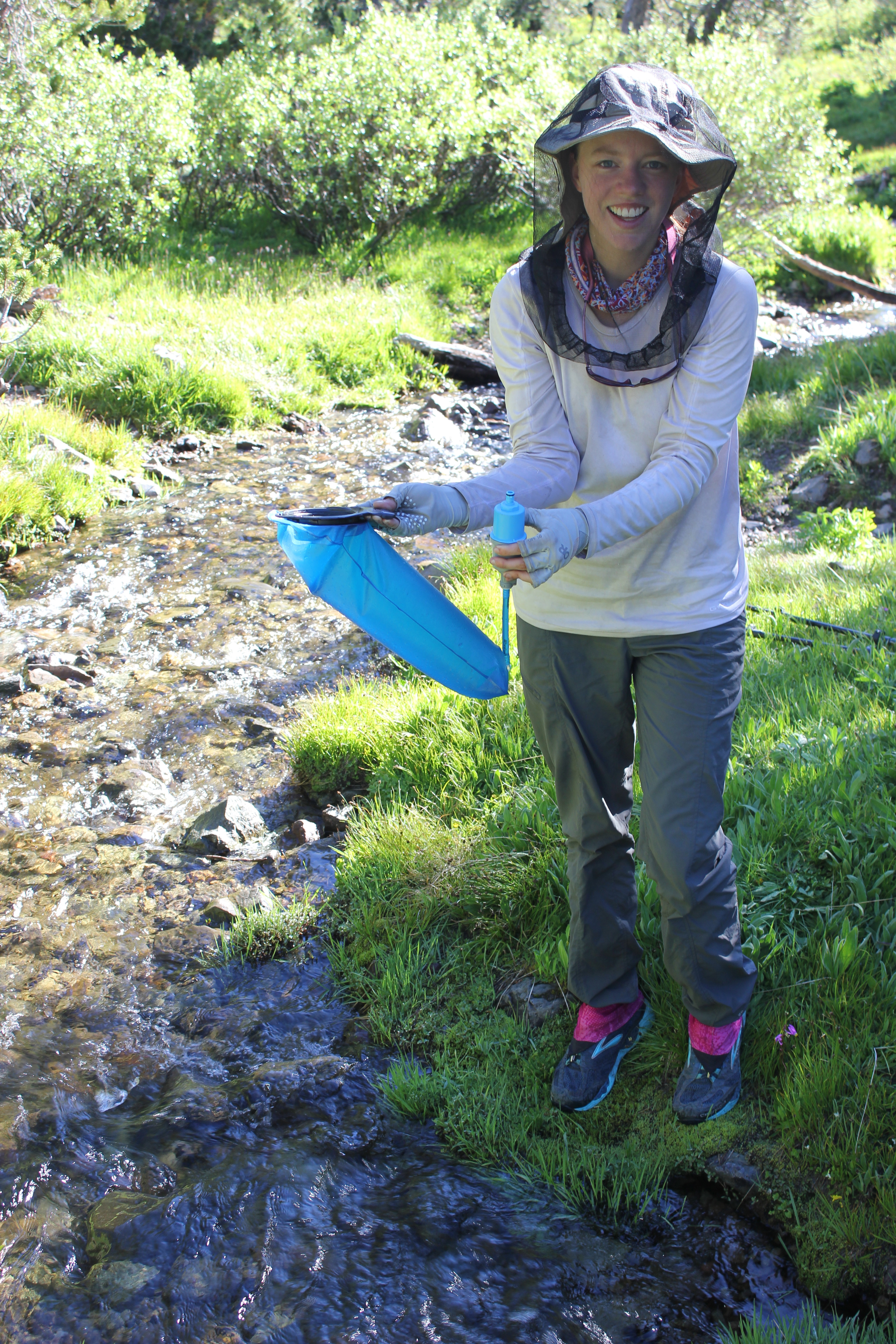
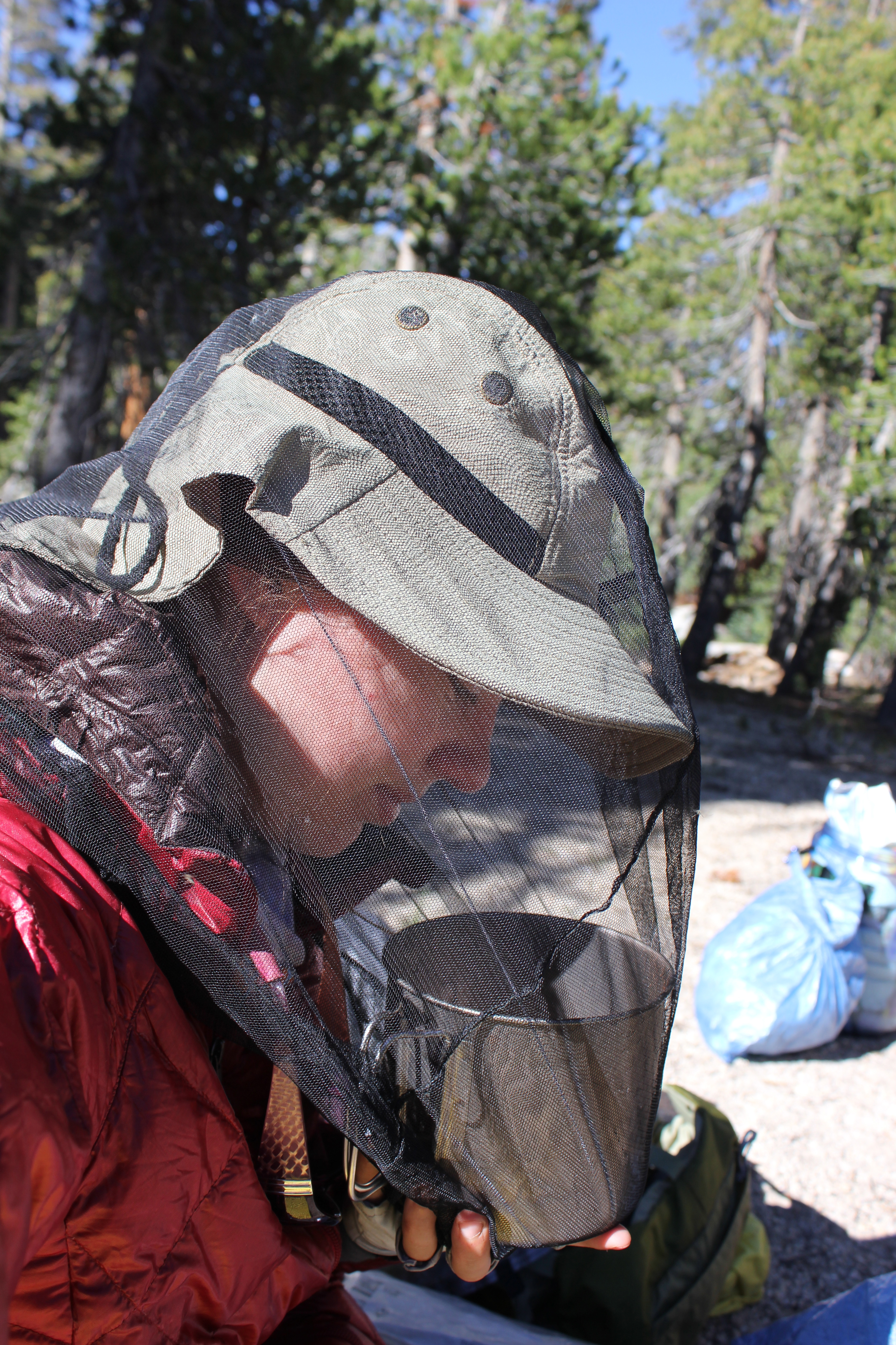
No wildlife in this section yet, except for the Sierra mosquitos that we’d heard so much about. Strangely, the mosquitoes were non-existant in Yosemite Valley, but they made their presense known up in the high country.

We climbed higher and higher over the next two days, averaging about 11 miles a day. We are really glad to have decided to slow our pace, mainly because our bodies can barely go any further than those 11 miles by the end of the day.
image

image

The mountain climbs, and especially the descents, wreak havok on the knees and foot bones. But, we’re also glad to have a slower pace because it allows us to take in the amazing scenery. We wish that we could have stayed at these gorgeous alpine lakes all day.
image

image

It was at these lakes that we had our first wildlife encounter of this section of the trail: giant, waddling marmots! They apparently liked the alpine lakes as much as we did. We couldn’t belive how fat and cuddly they looked, even larger than our cat at home! Unfortunately the marmots waddled too quickly into hiding before we could capture a picture of them, so here is a picture of our cat instead:
image

We miss her a bunch, and wish we could have taken her on the trail with us, but recent experiences prove that she would not enjoy it very much.

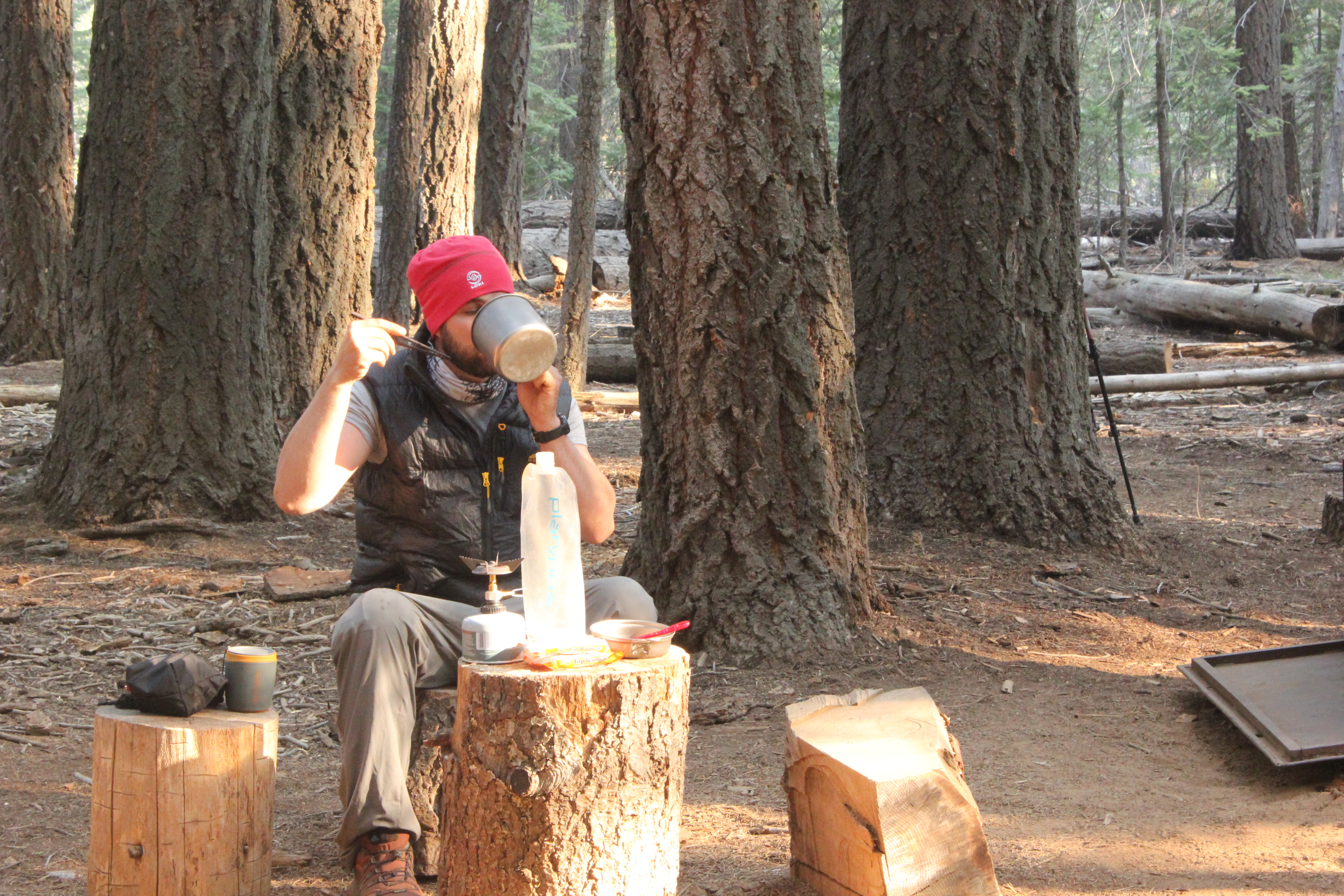
Every time the fifth day on the trail rolls around, we hit a block of some sort, either mental or physical. In the desert section, it was on the fifth day that we decided not to hike straight through to Kennedy Meadows, but rather to make a pit stop in Lake Isabella. Before Mt. Whitney, it was on the fifth day that we decided to take the “out” down to Lone Pine. This time, on our fifth day, we awoke to find ourselves floating on a water bed. The water had luckily not seeped in to our tent, but about 4 inches of water had pooled above our ground tarp, under our tent, giving our sleeping pads the sensation that they were floating. It was our first rain of the trip — our first truly overcast day! — and it was cold, and coming down hard. Fog was everywhere and we couldn’t see the tops of the mountains that were next to us. We made the decision to take a “zero” day on the trail, and we stayed put in the shelter of our tent…after moving it up to a slight hill, so that we weren’t camped in a swimming pool. We spent the day reading a Dean Koontz novel and playing solitaire as the rain poured down. It was nice.
image

image

The next day, it was still rainy and misty, but we needed to hike on. We had camped on an island between two rivers; it was a nice little spot with a fire ring in place from previous hikers. Before the rain had come two days earlier, it was simple to access the island from the trail by hopping across a string of conveniently placed rocks. But now, after more than 24 hours of solid downpour, those rocks were 2 feet underwater!

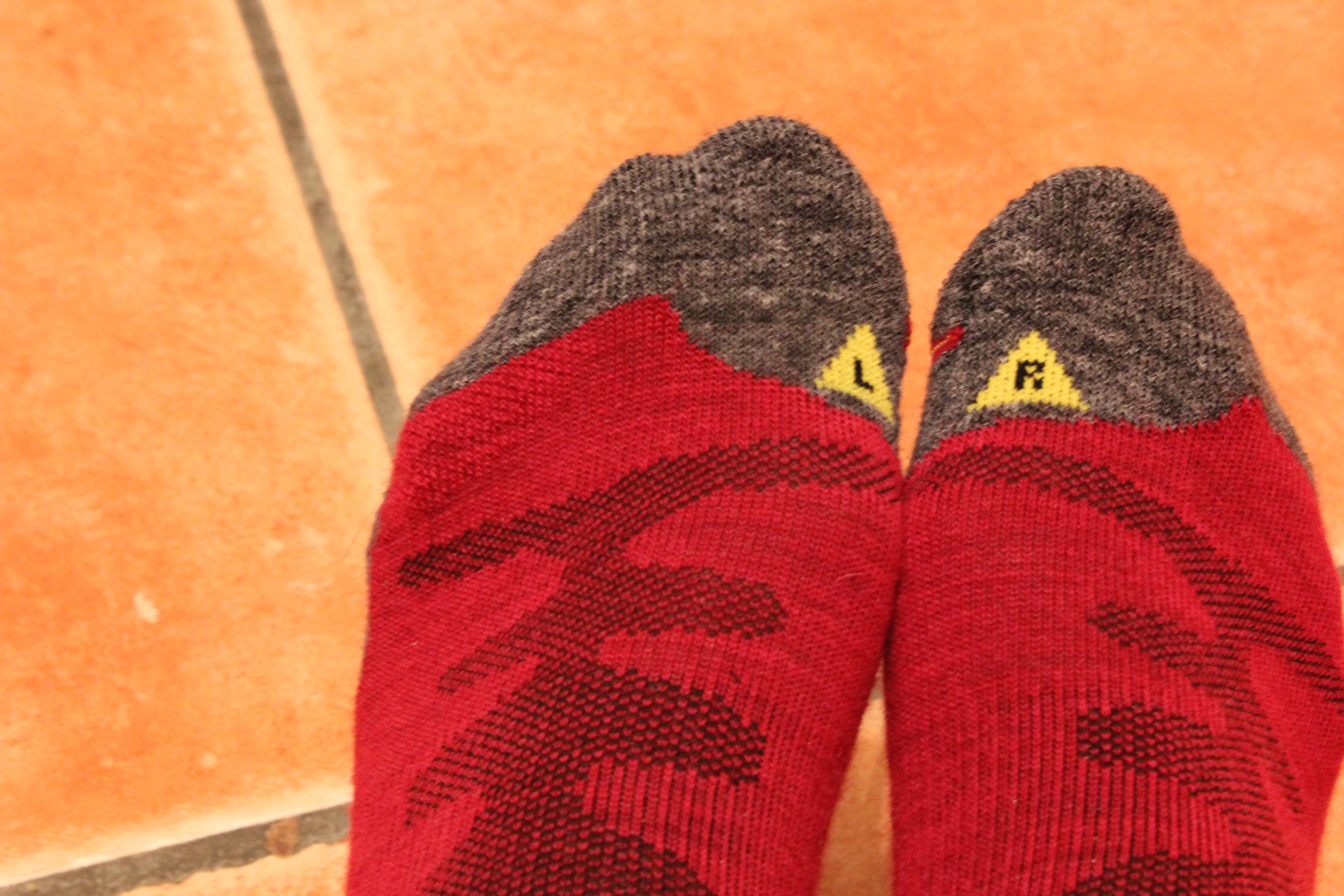
We scoured the island up and down, crawling through bushes and willows. We eventually found a fallen log to cross, and we made it back to the trail safely. We discovered that much of the trail itself had turned into a river, and in places where the trail inclined or declined, the trail had turned into a waterfall! Needless to say, we were hiking with wet feet, but our Keen socks happily kept our feet warm.
image

image

image

A few wet miles later, we came across a major river…with no log to cross on. Up until this point, all of our river crossings had been made above the water on a log or rocks. This time, the swollen river rushed swiftly, but there was nowhere to cross without getting in. Our guidebook mentioned that there was a log 50 to 100 yards upstream, so we climbed along the river bank for almost a mile, but there was no longer a log. We circled back on the trail and once again came to the point where it intersected the river, after a 2 mile detour. We decided to check downstream to see if there was anything that could help us across. A short distance down, there was a fallen tree stretching all the way across! Hurray!
image

Paul went first, and as he neared the end of the tree, he paused as vertigo overtook him. He slipped at the last possible second, but by that point, he’d made it far enough over that he was able to catch himself on the shore without landing in the river. Katherine watched, and didn’t know that he’d experienced vertigo. In fact, it didn’t look like he slipped, but rather that he purposefully hopped off the log onto the shore. She started across the tree just fine, since the tree was wider at the beginning. But halfway through the journey, the tree trunk narrowed to about 8 inches, and all she could see was white crashing water rushing beneath her feet. The vertigo! She almost lost her balance right in the middle of the river, but she reached out and grabbed a tree branch that was poking out of the trunk. As she reached for the branch, her trekking pole, which had been wound around her wrist, unwound, slipped off her hand and disappeared into the current. At this point, she began screaming bloody murder (hey, she’s not called Meltdown for nothing!), and stood clutching the branch for a good 3 minutes trying to regain her balance. Everytime she looked down, all she could see was the crashing water. Finally, she calmed and centered. Paul had gotten back up on the tree trunk ready to do whatever it took to get her across. Finally she took two more steps towards him and held out her remaining pole which Paul grabbed and pulled her to safety. Whew! Adrenaline. It was scary, and we were both giddy with relief afterwards.
image

A few miles later, after climbing and descending another mountain through the rain and fog, and lamenting the lost trekking pole, we came across another river, this one even angrier than the first. We once again walked along the riverbank for a while looking for the best place to cross. This time, we found a nice wide log with lots of traction.
image

We made sure our electronics were secured in our waterproof Aloksaks and Zpack bags, and then made our way across the log. This time, Katherine went first, and though the bungee cord on her gater got caught on a tiny branch, she successsfully backed up without a problem, unlatched the bungee and carried on. Once again, we were flushed with relief and adrenaline to have crossed such an intense river safely, and were pretty sure that was the last major river crossing of the day. We hiked back down to where the trail met up, only to discover the awful truth….we were on another island! We had to cross yet another river to get to the the trail! This final river was not crashing white water, but was wide, deep, and swift moving. We couldn’t be sure how strong the current was, but after checking the perimeter of the entire island, it became clear: we were going to have to swim.

In prepping for the trip, we had watched many videos of PCT hikers swimming across rivers with their packs, but it was always on hot, sunny days, when anyone would want to jump in to a beautiful crystal river and cool off. But on this day, it was so cold that we could see our breath, we hadn’t seen the sun in almost 3 days, and the idea of submerging into ice cold water seemed insane. But it was our only option, unless we wanted to head back to Tuolumne Meadows, 40 miles away. We stripped off our thermal clothing and underwear, and secured it in a Zpack. We wore only our rain pants, rain jacket, shoes, and (already drenched) socks. We took our packs off. When crossing in water, it is best not to wear your pack, or at least not have it buckled to you. That way, if the current is really strong, you won’t get pinned down by your pack.

We didn’t know this ahead of time, but we made the happy and wonderful discovery that our packs actually floated! They were covered in their yellow rain covers, and we placed the packs in the river with the rain cover in the water. It made a little backpack boat…awesome! Katherine went for it first, pushing her backpack boat ahead of her. The current was strong but not too bad. The icy water climbed up the legs past the waist, up to the chest. She walked on, gasping from the cold. But halfway across, she realized she could still touch the bottom of the river and was able to continue to walk. She yelled out to Paul behind her, “Hey, This isn’t so bad!” and made her way to the shore. Once she got out, she watched Paul cross the river with his backpack boat, who looked like a determined sea otter.

We were both totally gleeful and delirious with joy once we made it across…our first true river crossing with packs! It felt like the energy of the trip suddenly changed from hardship and trials to fun and adventure. And then, as if some sort of magical sign from the heavens: just as Paul got out of the river and we set our packs on some tree stumps, the sun burst out through the clouds and shone right on the spot where we were standing, dripping wet and shivering. Literally the first sunshine that we’d seen in days! It only lasted about 45 seconds before it vanished again in the veil of clouds, but we took it as a very good sign.

We got back on the trail, and made our way up the mountain a little ways until we found a nice flat spot to change out of our rain gear and back in to dry clothes. We made some warm tortilla soup as well. While we ate, we began to talk about that feeling of isolation on the trail, and how we hadn’t seen anyone else for a couple of days…were we the only ones out in the mountains fording the rivers, and hiking in the rain? Were we all alone out here in the middle of nowhere? In those videos of PCT hikers fording rivers in the sunshine, there was always a group of them doing it together, but we had been by ourselves…The whole time we’d been unsure: was there actually a bridge downstream that we’d missed that all the other hikers knew about?

Suddenly another hiker appeared, just as we were having this discussion. He had taken a zero during the rain as well, listening to audio books on his ipod in the shelter of his tent. He had crossed the same skinny tree that we had on the first river, and claimed that he’d almost lost his life on it. In fact, he said that the tree had actually cracked when he was three quarters of the way across. How scary would that have been?! And get this: he lost his trekking pole on that same river. There must be a beaver downstream of that skinny tree with a dam made of trekking poles. This hiker crossed the second angry river on the same big log that we did, AND was met with the same slap-in-the-face realization that he was on an island and had to cross yet another river.

So we weren’t alone after all. This hiker had been experiencing everything we had been, just a half-hour behind us, and he had done it all by himself! We hiked with him on and off for the rest of the day, and even encountered one last wide-but-shallow river to cross before we set up camp that evening.
image

We also came across another hiker, a young guy, who asked for a hug because he’d had a terrible time crossing those rivers: in the river, he lost his ipod, Chrome Dome umbrella…and his camera!
image

image

It remained cloudy for the rest of the day, but began to break up by sunset. That night, the sky was completely clear and full of stars. The next morning was leisurely, as we took time to dry out our tent, socks, and shoes, and solar charge our phones. We didn’t start hiking until 11 am.

And then another breakthrough: our first 18 mile day. Though we got a late start, we realized we’d already gone 8 miles by 1 pm, and we decided to push for the distance.
image

image

The terrain was relatively flat and full of mosquitos (trust us, those little buggers propel you to move it along quickly!). Plus, we realized that if we did 18 miles that day, we could make it to town the very next day.

Enchiladas!
Pancakes!
Ricotta-filled ravioli!
Showers!
All this and more could be ours if we made it town.

So we did it. 18 miles. That night, our feet hurt so bad that we couldn’t sleep for a long time.
image

The next day was an exciting one: our first ridge walk, and town – town – town.
image

The ridge was beautiful, but harder than we imagined, and we were still recovering from the 18 miler the day before.
image

image

It was a steep climb to get up there, and the trail was full of loose rocks and snow fields. We used our crampons for the first time, and they worked great, but it was tricky because the snow fields were interspersed with rock fields, and you can’t wear crampons on rocks. It’s pretty time consuming to keep putting on and taking off crampons so we only used them for one really wide snow field, and didn’t bother using them for the others.
image

image

We finally made it to highway 108 at Sonora Pass around 4 pm. Turns out, a group of Trail Angels were doing Trail Magic there, and we immediately got served some sodas and hot dogs. We secretly hoped they would give us a ride to town, but didn’t want to flat-out ask them. None of them offered, so after we thanked them for the snack, we headed out to the highway to hitch for a ride. After an hour and half, we still were waiting for someone to stop. True, there wasn’t a ton of traffic, but we thought that surely someone would stop. No one did, and it was getting late. We headed back up to the Trail Magic just as they were serving a pasta dinner. We were very grateful for it, and decided to camp there for the evening and try for a hitch again in the morning.
image

Though we didn’t get in to town that night, we were treated to a beautiful lightning storm and cloud show in the distance (it didn’t reach us), and we were happy.
image

The next morning at 8 am, we were back on the highway again. A few cars passed without stopping, and Katherine almost melted down, thinking we’d never get in to town. The pancakes, the enchiladas, would never be had. We would starve on the side of the highway…dirty, sunburnt, and smelly.

But then an Angel arrived in a shiny red truck. His name was Paul (already a good sign!), and he was headed right through the town that we wanted: Bridgeport. Just when we had thought all hope was lost, he saved the day. He kindly drove us the entire 30 miles, even took us on a field trip to visit the nearby hot springs, and dropped us off right in front of a quaint little motel in the darling cowboy town of Bridgeport. Thank you Paul!!
image

Bridgeport has been a wonderful town stop. Friendly people, good food, nice library and motel. We’ve been very happy to clean up here and rest up. Our plan is to hitch back to the trail tomorrow and hike in to Lake Tahoe in about 8 days.

Some folks have asked about sending mail to us along the trail. We love getting mail, especially if it’s edible! Thank goodness our appetites have returned in the alpine climate after having been absent in the hot desert. We love getting letters and postcards, too! The “contact us” page above has the addresses that we will be picking up resupply packages. To mail to us in Lake Tahoe, you can send to:
Katherine Wroble and Paul Barney
General Delivery
South Lake Tahoe, CA 96151

Yosemite Valley: Close Encounters of the Bear Kind

6/15/2013 – 6/19/2013

The Pacific Crest Trail goes right through Yosemite National Park.  It cuts across the less popular (but not less beautiful!) part of the park called Tuolumne Meadows, which is a high Sierra camp. Most Yosemite visitors (95%, according to the ranger) never see that part of the park; they only see the part called Yosemite Valley, which is home to Half Dome and El Capitan.

image

We planned to pick back up on the PCT at Tuolumne Meadows (by the way, it’s pronounced too-AH-la-mee), but we certainly didn’t want to miss the opportunity to see Yosemite Valley. So, from Mammoth Lakes, we caught a YARTS bus on Saturday morning into Yosemite Valley (they only operate on weekends since it’s still pre-season). The YARTS bus is a nice big tour bus, with plenty of space and power outlets.  There weren’t many others along for the ride, so we had room to spread out. On the ride, we chatted with a PCT thru-hiker named RoboCop. A retired police man, he is hiking the PCT for the third time, and has also hiked the CDT a few years ago. Wow!

The YARTS bus passed through the beautiful Mono Lakes area, and made a pit stop at the Whoa Nellie Deli, which is mentioned in our PCT guidebook.

image

A nap was eventually in order because it’s a 4-hour bus ride. But we all woke up when we entered Yosemite Valley! When the bus passed through the tunnel, and the scenery opened up to reveal a scene reminiscent of the oasis in The Land Before Time movie, everyone on the bus (all 10 of us) gasped and oohed and ahhed. El Capitan’s stark white walls loomed overhead, waterfalls sparkled, meadows gleamed, Half Dome poked out in the distance. It was a magical sight to behold.

image

Up until this point, we had been blessed by the pre-season gods: cheaper rates, no crowds. But we were in for a rude awakening when the bus dropped us off at the Yosemite Visitor Center. There were swarms of people everywhere.  It felt like standing in the middle of Grand Central Station! We sat on a bench out front for a while just soaking it all in. Even the squirrels were more aggressive here than they are in Manhattan’s Central Park.

Finally, we made our way to the Wilderness Center to get our bearings and find out where to camp and how to get to Half Dome. We didn’t realize that everyone who climbs it and camps in the backcountry needs a permit. Our PCT permits didn’t cover us, but the helpful ranger issued us the permits we needed without hassle. National Parks tend to be pretty permit-happy, so we weren’t surprised. However, we WERE surprised to hear about another hiker’s permit experience: As we were leaving Yosemite Valley a few days later, another PCT hiker we met told us that he was instructed by a ranger to wait two days, then enter a lottery, and then only if he won would he be allowed to hike Half Dome and camp in the backcountry. We couldn’t believe how difficult it could be to obtain Half Dome permits, and how easy it had been for us to get our’s…on a Saturday, no less! We feel very grateful and fortunate that we were able to climb those elusive cables up Half Dome’s wall.

After we got our permits from the Wilderness Center, we camped for one night at the backpacker’s camp on the Valley floor. The next day, we hiked up Mist Trail past two incredible waterfalls (Vernal Falls and Nevada Falls) and into the backcountry base camp for Half Dome called Little Yosemite Valley.

image

image

image

Shortly before we reached the campground, we stopped short…a bear scurried across the trail! We were stunned for a moment since this was first bear encounter we’d had on the trail. Though she was walking away from us, we still did as the rangers instructed by not approaching the bear and by shouting, trying to sound angry. But the content of our shouts was along the lines of “You are such a cute bear! Oh, you have a tiny cub with you! Oh, you have TWO cubs!” We continued to shout until she and her baby bears were out of eye sight. Seeing a bear and her cubs was quite a thrilling experience. It would have been scary if she’d come towards us, especially since she had cubs, but luckily she seemed to want to get away from us quickly. According to the park rangers, it’s important for people to maintain a bear’s instinctive fear of humans (by shouting, banging pots and pans, waving your arms over your head until they retreat). When bears lose their natural fear of people, they can become aggressive towards people. Leaving food in your tent or car teaches bears that they can find it there. And that’s when they do things like climb in to tents and cars in search of food. Sadly, they usually have to be killed when they become aggressive. We don’t want to be the campers responsible for the death of a bear, so we have been diligent about keeping our food and toiletries in our BearVault canisters, and we stow the canisters at least 100 feet from our tent, or in a bear locker if there is one.

image

Little Yosemite Valley was a great campground with neat catacombs forming the individual sites. Deer would stroll through our site a few feet from our tent practically every hour. We took a dip in the crystal clear river near our site and went to bed, excited to climb Half Dome the next day.

image

image

The hike to Half Dome was crowded but worth it. It was so much fun to climb the cables. 

image

image

image

For us, it was reminiscent of the Angel’s Landing hike in Zion National Park, because you climb up  for a long time, the last stretch is using cables, and the view is down on the Valley floor where you can see the shuttle buses and cars drive by…so small they look like knats. Very fun and exhilarating. 

image

image

image

That night was spent at the base camp again (our first time camping in the same spot two nights in a row!). The following day we walked down the steep and rocky trail past the two waterfalls again and into the backpacker’s camp on the valley floor.

While the scenery at Yosemite Valley is breathtaking, the park simply doesn’t have a handle on crowd control. The shuttle buses are always packed, and the road tends to be a non-stop traffic jam. Of all the national parks we’ve been to, Yosemite has seemed the most crowded and congested.

If we could devise a perfect trip to Yosemite Valley, it would look something like this:

-Stay at the Ahwahnee Lodge. It’s an epic and beautiful place to get a reprieve from the crowds. If you have to camp, make sure you at least have a dinner there once…the dining room alone looked like the Great Hall from Harry Potter.

-Bring your bikes. Once you park your car, don’t drive it again for the duration of your stay, unless you like being stuck in an L.A. style gridlock traffic jam. The bike lanes along the valley floor are flat and lovely.  They go everywhere in the Valley.

-Hike to the waterfalls and Half Dome at dusk or dawn.

-Go during off-peak seasons. If it was this crowded during the off-peak season in June, we shudder to think of what the crowds are like during July or holidays.

– Spend some time hiking the meadows near the high country camps like Tuolumne Meadows or White Wolf. It’s gorgeous up here, and not nearly as touristy.

– Visit the giant sequoia trees at Mariposa Grove (we didn’t get to do that this time).

After 4 nights in Yosemite Valley, we took a shuttle out to Tuolumne Meadows.  As nice as the campgrounds were in Yosemite Valley, we somehow managed to camp next to frat boy parties and their kegs every single night.  At the Tuolumne campground, most of the other campers are other PCT and John Muir Trail hikers, so it’s much more mellow. We are glad to catch up on some rest before we hit the Trail again tomorrow.

After a week off the PCT, we’re a bit nervous about how our bodies will take it. The last time we were on it was right before Mt. Whitney, and we weren’t doing so great, physically. This next section should be cooler in temperature than the previous sections we’ve hiked and scenically stunning, but we won’t have an “out” from the trail for 70 miles. It’s quite the commitment!

And, we just noticed something interesting in our guidebook, Yogi’s PCT Handbook, about the upcoming section north of Tuolumne: a three-time PCT veteran is quoted as saying, “This section, every year, is the hardest for me PHYSICALLY.  Also, the worst mosquitos.”

Great.

Sierra Resupply Towns: Lone Pine and Mammoth Lakes

6/12/2013 – 6/15/2013

Lone Pine is a splendid little town straight out of an old western movie. In fact, a lot of western movies were filmed here back in the day, and the restaurants here have all sorts of photographs and memorabilia from those films to show for it.

image

There is a charming main street lined with a ton of climbing and outdoor gear shops, restaurants, cafes, motels, and a funky little grocery store. Any thru-hiker can safely resupply at this town without having to mail themselves anything.

After Robin and Bill dropped us off (thanks again for the lift!), the first thing we did was check in to the Whitney Portal Hostel. As luck would have it, it was three days before peak season rates kicked in, so we got a great deal on a private room and bath. In our private room, there were 4 bunk beds to choose from!

image

It was so nice to stretch out on those beds. After a quick rest and shower, we went off in search of food. We came across a great Mexican restaurant where we gorged on enchiladas and chili rellenos. We also ran into some other thru-hikers that we’d met in the desert section out of Tehachapi. Everyone was in good spirits and happy to be in town.

image

We would have gladly stayed in Lone Pine longer, but adventure lured us out of our bunk beds at 5am the next morning. We caught a CREST bus that gave us the locals’ tour through all the main Sierra resupply towns along highway 395: Lone Pine, Independence, Bishop, and finally Mammoth Lakes, where we got off the bus. The CREST bus is a small shuttle bus that the locals use for their morning and evening commutes, hence us getting up at 5am.

image

It was nice to catch a glimpse of their lives as they were picked up and dropped off along the route.

We got off the bus in Mammoth Lakes, a ski resort town. Naturally,  all the shops had a ski and snowboarder bum vibe, which we really liked!  We had a few hours to kill while we waited to check into the the Motel 6, so we were able to explore the local coffee houses and gear shops. We also had an amazing breakfast at a bonafied small town diner: The Breakfast Club. Yum!

image

At the Mountaineering Supply Store, we picked up a few pieces of gear that we’d come to need along the trail.

Katherine got:
-A hose valve and cover, so that her Camelbak hose wouldn’t leak and wouldn’t get covered in dirt when she set her backpack on the ground.

image

-Insect repellent long pants. So far, she’s just had her yoga capri pants, but now that we are getting into mosquito country, long pants are necessary.
-New sunglasses.  Her other ones broke.

Paul got:
– A new belt. His old belt was too big. His new belt is made from the same fabric as a backpack strap with the same type of buckle, so his belt can be multifunction as a compression strap if needed.
– Sun sleeves. We both love our sun gloves, and they keep our hands from getting sun burnt when we walk with trekking poles. But Paul’s shirt is short-sleeved so his forearms have been getting burnt. Sun sleeves are great because they’re breathable,  warm yet cool, and much easier to deal with than greasy sunscreen.

image

After we checked in to the motel, we spent the rest of the day showering and washing our clothes (in the shower). A tip: To save on money and time, we wash all our clothes with shampoo in the shower.Now when we smell our bandanas (Buff’s), we get a nice whiff of Herbal Essence. We make sure to rinse out the tub of all the dirt, and leave our hotel rooms in clean shape. We don’t want to give thru-hikers a bad name in the motel community!

Our second night was spent at the New Shady Rest Campground. This campground is AWESOME. It is just as close — in some cases, closer! — as the Motel 6 is to all the shops and restaurants in Mammoth Lakes.  The camp sites are affordable, quiet, spacious, and secluded. They are nestled in lovely pine trees.

image

And…the campground is right down the street from the movie theatre, so we snuck in a screening of the new Superman movie.

Though it was a wonderful two days in Mammoth Lakes, it was time to hit the road again. After a good night’s rest at the campground, we crossed the street the next morning and hopped on a bus to Yosemite National Park!

image

Kennedy Meadows: A Whole New World

6/8/2013-6/12/2013

In Kennedy Meadows, we received our bear canisters that had been ordered from BearVault. We also received our first resupply box that we had mailed to ourselves, which was packed with goodies.

image

image

After drinking a couple of cold sodas at the Kennedy Meadows General Store, squeezing food into the new bear canisters, and figuring out how to fit them into our packs, we were on our way. As much fun as it is to meet people on the trail, it is a bit overwhelming to meet other hikers in situations like Kennedy Meadows. It is chaotic, people are coming and going, and the energy feels unorganized and slightly lethargic. Hikers jokingly refer to Kennedy Meadows as “the Vortex” because you can get sucked in to the lazy days and suddenly a week has passed! For us, just a few hours passed before we bounced.
image

The hike out at 4pm was lovely. We stopped for a Top Ramen dinner at the Kennedy Meadows Campground a few miles down the trail. It was a great campground with nice sites, tables, and restrooms (oh, the luxury! ), but it was still daylight and we still had energy so we continued for a few more miles.

image

It was easy-going because the searing heat of the desert was behind us and we walked amongst the shade of giant trees. Paul was excited to camp near the river, so we kept our eyes peeled for a nice spot. We found a lovely one next to the South Fork Kern River at PCT mile 707.1. At dusk, Paul skinny-dipped and soaked off the day’s dirt. Though the water was crystal clear, you couldn’t see the river floor because it was too dark, and thus Katherine was too scared to go all the way in to the water– so she just stuck her feet in.

Every night for the next 3 nights was spent camped next to a river or creek — the Swallow Bridge by South Fork Kern River mile 716.7, Death Canyon Creek, Diaz Creek…Though we were still technically in the desert, it was a whole new world from the land near Tehachapi. So much water! We didn’t have to carry 6 liters at a time anymore. We didn’t have to wake up at 5am to beat the heat. We could walk during the middle of the day and not be met with oppressive heat waves. In fact, a few of the mountain passes actually got a bit chilly.

image

A normal day started with a steep climb in the morning, then a gentle descent in the afternoon and evening. Though the temperature and  water situation was much more favorable now that we were at a higher elevation, our bodies still struggled to adapt to the strain of waking and walking, waking and walking, day in and day out.
image
Mt. Whitney drew ever closer. Though we were excited, we were also nervous. We were averaging about 12 miles a day, and that was with barely any breaks. Katherine’s appetite had sort-of returned, but not really. Neither of us were eating as much as we should considering the energy that we needed for those daily climbs. Mt. Whitney is 17 miles roundtrip from the PCT– farther than we had yet to go in one day. When we completed a 15-mile day, we were dizzy and grouchy with fatigue. We worried that our bodies weren’t ready for the demands of the High Sierras…
image

25 miles before Mt.Whitney,  we had an out. There is a side trail at PCT mile 744 that goes down Mulky Pass and leads to the town of Lone Pine, CA. Mentally, we wanted to stay the course and hike Mt. Whitney! Physically, our bodies wanted to go to town, eat enchiladas, take a warm shower, and sleep in a bed. After internally debating, our bodies’ demands eventually won and we took the out.
image

The 30 mile hitch from Horseshoe Meadows Campground (where Mulky Pass leads) to Lone Pine is a tricky one, especially during the week when there aren’t any campers. Except for a man on a horse in the distance, there wasn’t a soul around when we arrived at the campground, just as we’d feared.
image

But then!  Not 30 seconds after stepping foot off the dusty trail onto the asphalt road, a car appeared out of nowhere! Robin and Bill (trail names: Trail Behind and Huzzah…) are PCT section hikers who had just completed a 4-day hike including Mt. Whitney. They were on their way down the mountain and gave us a lift, dropping us off right in front of the Whitney Portal Hostel in Lone Pine! It was perfect luck and we are so grateful to them for the ride.
image

Lake Isabella And Beyond: Hitchhiking and Trail Names

6/6/2013 – 6/8/2013
Lake Isabella provided our much-needed relief from the heat of the SoCal desert. Even though it was 105º F while we were there, we were safe in our air conditioned room at the Lake Isabella Motel.
image

We even got to take a dip in the pool, and we tried the famous milkshakes at Nelda’s diner.
image

After taking our first “zero” (a zero is a day when you hike zero miles), we were restored and ready to tackle the trail again. 7am the next morning found us at the highway entrance with our hitchhiking sign and our thumbs out. We were trying to get a ride to the Kennedy Meadows General Store where we could pick up our first resupply box full of food. Several cars passed. We waited about 10 minutes.  A man with a mural design company advertised on the back of his van pulled over and took us a few miles east to a town called Onyx. He said we’d have better luck with a hitch from there because it was next to a swap meet, and there would be more people. We stuck our thumbs out again and waited another 15 minutes or so. Then a man at the swap meet walked up to us and offered us a ride. His name was John. A retired chemist, he was spending his leisure years as a truck driver.  That day, he was just driving his van, not his semi truck, so we missed the opportunity to ride in a big rig this time. He dropped us off on Chimney Creek road. He said it was a much shorter way to get to Kennedy Meadows than hitching all the way out to Highway 395 and then up Kennedy Meadows road. We were hesitant about the new route but liked the idea of a shorter distance. We also liked the idea of not having to hitch on 395 because that’s a big highway with fast-moving vehicles. So we started walking along Chimney Creek road with 28 miles to go before reaching Kennedy Meadows…and not a single car did we see for a few hours. We walked about 10 miles over a mountain pass and saw some mountain lion paw prints in the road along with several squigley snake tracks.  We finally came to an empty campground and stopped there for a snack — green apple, pear, and cheddar Ruffles. Of course, as soon as we were off the road eating a snack, we saw a car drive by! We were too far off the road to stop it! Luckily another car soon came by and actually drove into the campground. Paul chatted with the driver who asked if any of the site spigots had water in them (they didn’t). The driver (Jim) was in the area scoping out watering holes for his horses so that he could take them camping with him. Turns out, he was headed right to the Kennedy Meadows General Store anyway, which was exactly where we were trying to go! And just like that, we were there! It only took us about 6 hours from Lake Isabella…If we’d had a car, it would have been a 45 minute drive.
image

Kennedy Meadows was exciting. The main destination for anyone in the area is the General Store. It has anything a hiker could want…mac and cheese, chilli, and Ben & Jerry’s ice cream!
image
image

Of course, there are swarms of backpackers/hikers everywhere forming little cliques and socializing, though everyone is friendly.

image

Prior to hiking the trail, we were apprehensive about encountering packs of other thru-hikers. We wanted to enjoy the solitude of nature and weren’t sure if we’d like the company. Well, it turns out, seeing other hikers is one of the best parts of our day! It is so easy to feel like we’re the last people on the planet when we see the vast expanses of landscape and there’s not another soul in sight. The broad and empty terrain is amazing, but a little lonesome sometimes. That’s why it’s always such a treat to run in to another hiker on the trail (though usually, it’s the other hikers running into us since we hike at such a snail’s pace, thanks to Katherine). It’s fun to hear about the other hiker’s experiences on the trail and learn their unique trail name.

In trail culture, every thru-hiker earns themselved a nickname that they use with other hikers throughout their journey. Typically, they use the same trail name for every other hike they may do in the future. Paul’s trail name is Blamo because it’s one of his favorite words to use in any context. Katherine’s trail name is Meltdown, named after the one (or seven) meltdowns she may (or may not) have had in the desert. 😉

North from Tehachapi: The Scorching Hot Learning Curve

Well, nobody said this hike was going to be easy. It’s taken us 5 days to hike about 50 miles. The heat (in the 80’s and 90’s), our pack weights (40-50 lbs), and general exhaustion have all taken their toll on our unprepared bodies.

The PCT adventure started out beautifully. Katherine’s mom drove us to the trailhead (Thank you, Jerre!) near Tehachapi off Highway 58 around 4pm on June 1st. It was a clear, hot day, though hazy with smoke from the nearby Powerhouse fire.
image

As we said our goodbyes to Katherine’s mom and took tons of pictures on the side of the road, a female solo hiker zoomed up in a taxi, put on her pack and marched off down the trail…just like that! No fanfare, no ceremony, just a girl on a mission.

We were fresh and excited as we headed north from Tehachapi and climbed the steep ascent of switchbacks right off the highway.
image

As evening appoached, a cayote trotted across the trail in the near distance. After about 4 miles uphill, the sun was setting, and we thought it best to set up camp.

image

We had a small dinner of energy bars and a bagel, and then went off to hang our food bags by the light of our headlamps. We spotted a black widow spider with the red dot on her belly.  At first, Katherine was slightly creeped out, but then became very fascinated. The spider had dug a hole in the ground and built a precise wormhole-type web in the foliage leading to the hole. As soon as our headlamps shone on her sitting in her web, she immediately crawled down into the hole to hide.  She was more afraid of us than we were of her!
image

That night, we camped overlooking Highway 58, and had a view of hundreds of windmills that this area of Southern California is known for. As the sky darkened, we saw the red blinking lights of each windmill create really cool patterns across the landscape! We also saw the actual flames from the Powerhouse fire break over the crest of the mountain about 40 miles south. It looked like molten lava. It was simultaneously spooky, beautiful, and sort-of prehistoric looking. Don’t worry, we were hiking in the opposite direction of the fire.

The next morning was our second official day on the PCT. We were having a great time so far, and rallied at 7am. The trail took us along the crest of a mountain with lovely views (and more windmills).

image

So far, we have been fortunate to not experience much wind on the trail — just a gentle breeze. We stopped in the shade around midday and cooked some mashed potatoes with vegetables. After a nice break, we carried on.

The rest of the day had gorgeous scenery, was very hot and eventually became exhausting. Katherine stepped right over a full-bellied snake without even realizing it until Paul pointed it out.
image

We pushed through a grueling 12 miles until we reached our very first watering hole, Golden Oaks Spring! Many other hikers had gathered here. When we arrived around 7pm, there were about 15 people hanging out, chatting about the trail, and cooking.
image

We heard that one hiker who had passed us that morning had stopped at the watering hole and baked bread that afternoon! Once we’d replenished our water supply, we backtracked 1/4 mile to a nice campsite we’d spotted. As we set up camp, several other evening hikers passed us, completely dehydrated. We cheered them on saying they only had 5 minutes to go before the watering hole.

The following morning was our third day on the PCT. We cooked some rice noodles and veggies. Our eyes were bigger than our stomachs, and we couldn’t finish the meal. Neither of us had much of an appetite. We passed the watering hole once more and stocked up on water again.
image

The trail started out nice and shady, but soon opened up into a burned section that lasted most of the day.
image

The fire happened just last year, so the ground was still sandy and sooty, and the trees were all black skeletons. It looked like the Elephant Graveyard from The Lion King.
image

It was scorching, and both of us were in sour moods. Katherine had two identical little blisters on both feet. She stopped to treat them, and the heat continued to drain the energy from both of us. In a momentary lapse of judgement, we decided to split up. Paul wanted to hike through the heat to get out of the burned section as quickly as possible while Katherine wanted to take cover in the shade. We spent the next 3 hours apart, and it was lonesome and creepy. We were both worried about the other person, and we were relieved to join up again down the trail. By this point, our bodies were in a total state of shock. Paul’s muscles were sore, and Katherine experienced waves of nausea. We encountered a wonderful campsite, and though it was early, we decided to stay for the night. Several other hikers eventually made their way to the campsite that night, and we experienced our first good night’s rest so far.

The next morning’s sunrise marked our 4th day on the trail. Steep ascents along the mountain woke us up and wore us out.  Nausea and dizziness overcame Katherine as we crested the mountain. Food was still not appetizing to either one of us due to the adjustment to altitude and heat. After a breather in the shade, we put in our headphones which really gave us a mental boost and helped us push on to the next watering hole, Robin Bird Spring, 9 miles away.
image

When we arrived at the water spring, we once again were greeted by a new group of hikers and we rehydrated during the heat of the afternoon. We also made friends with a cute herd of cows who shared the water source. (We have been diligent about filtering all of our water, by the way).
image

After a delicious mac and cheese meal, we were energized and refreshed. At 4pm, we were on the trail again in good spirits. 4 miles later we came across a supreme and private campsite too good to pass up. The rocks even created natural shelves for our belongings!

image

We were happy and cozy as the sun set and we watched the Big Dipper appear in the sky.

image

Unfortunately, the next morning, Katherine was not feeling well. The nausea had reached new heights of discomfort, and though we had already packed up our tent and all our belongings at 6am, we opted to stay put for the morning and not hike. We unpacked the tent again, and both recuperated.

image

We had a heart-to-heart talk about how the hike had been going so far. We have both felt pressured to hike more miles than we are capable of because all the other hikers who have walked from Mexico are whipping through 25 mile days with apparent ease. That kind of stress about mileage and the crazy strain on our bodies was exactly the opposite of what we wanted from the PCT experience. We ultimately decided to be OK with going slow, enjoying the scenery and nature, and not pushing so hard. Over the course of the journey, we hope to gain strength and get in shape while staying in tune with our body’s needs. We made the decision to stop at an unplanned town, Lake Isabella, to replenish our minds, bodies, and food before the next section of the hike. We will also be picking up a new fuel canister in town, since Paul realized that our back-up canister isn’t compatible with our stove.

Around 3pm that day, we finally broke camp and hiked 10 miles into the night. We stopped at a very refreshing water supply, Landers Meadow, in the mid-afternoon. Pouring that cold water on our clothes felt like heaven!

image

We carried on, mostly downhill. Around sunset, Katherine spotted a lovely campsite with a rock-made reclining chair. Paul convinced her to move on so that we could get to the end of the section by the end of the day.

image

Night closed in, and we descended 4 miles of switchbacks by the light of our headlamps. It was our first experience with night-hiking on the PCT. Though the temperature was mercifully cooler to hike in, it was very bizarre to hike with only a small spotlight to guide you. The trees look scary, the shadows are weird, and you can’t see any scenery. And the night creatures come out…We saw a snake coiled up flicking his tongue near the trail. We saw several big black beetles. They are gentle and harmless.  We saw tons of ant trails…one of them was at least 10 feet long! Dusk must be rush hour for the ants. Amazingly, they all keep to the right and stay in their own lane! So organized. Then, we began to spot gleaming diamonds/emeralds in the dirt. On closer inspection, we realized those diamonds were actually the eyes of small spiders reflecting the light of our headlamps! We finally made it down the mountain, with sore toes from all that downhill action. At 9pm, we hurriedly set up camp near the Kelso Valley Road water cache, which was very well stocked. Several hikers were already there and sound asleep. It was an uncomfortable night; too hot yet too cold, and noisy from a brisk wind.
image

This morning, we decided to sleep in…until 6:30am (regular hiking hours in the desert tend to start around 5am). It is our 5th morning on the Trail.  After stocking up at the water cache, we departed the PCT and embarked on a 34 mile walk along the paved, yet remote, Kelso Valley Road towards the town of Lake Isabella.
image

Along the road, we saw more wildlife than we did on the trail! Countless jackrabbits and cottontails darted by, golden falcons flew overhead, and a friendly turtle greeted us.

image

We hoped to hitch a ride into  Lake Isabella, but after 5 hours and 10 miles, only 2 cars had passed, neither of which had stopped. The temperature began to get unbearable.

image

The pavement wavered with heat waves.  We feared we might have to walk the entire way to town, and there wasn’t any shade. But then!  A pickup truck appeared! Katherine stuck out her thumb. A good man named Grant pulled over. He was in the process of moving the contents of an old mining camp and his truck was packed with antique glass bottles, but he graciously repacked everything in his cab so that we had room to sit. We put our packs in the bed of the truck. We all had a pleasant conversation (turns out, he has hiked the PCT before!) as he drove us the entire way to the motel in Lake Isabella. We are extremely grateful to Grant for saving us from heatstroke and a two-day road-walk!
image

The rest of the day has been spent showering (!), eating Subway sandwiches and Little Caesar’s pizza (!!), and hanging out in the AC of our room at the Lake Isabella Motel.

Stuff we’re really glad to have on the trail:
Sun Gloves.
Chome Dome Umbrella.
Sunblock.
Gaiters.
Foam sleeping pads. — not the inflatable kind!
Baby wipes.
Halfmiles Companion smartphone app.

Stuff we wish we’d brought:
Camp Shoes. — Even though ultralight hikers don’t agree with them, we find ourselves wishing for a change of shoes multiple times a day.
A watch.
An extra lighter.
More water containers. — We are drinking about 3 1/2 liters a day. Because of our slowish pace (about 10-15 miles a day), we should have left Tehachapi with 7 liters of water per person. Katherine had about 5 and Paul had 6. We had to ration our water so that we didn’t run out before we reached the next water supply.
Chips.
Brownie mix. — Apparently you just combine the mix with a liter of water and you have a delicious “cake shake”!
A donkey to carry everything.
image

image

We have a sponsor!

KEEN Footwear will be sponsoring our upcoming PCT adventure.

IMG_1187The sponsorship comes in the form of socks…which is perfect because that was one of the few pieces of gear that we were still up in the air about.

A box of KEEN’s Olympus socks arrived in the mail a few days ago. We each got 2 pairs of ultralight low-cut socks (which will most likely be in constant rotation as we hike) and 1 pair of medium weight crew socks (which will most likely be used for sleeping). It’s nice to have one pair of socks that you only use for sleeping. After all the trials and tribulations that your feet endure, they can at least count on a dry pair of socks to snuggle up in at the end of the day.

IMG_1169KEEN will supply us with new socks throughout the Trail as needed, though it might not need to be very often because the fibers in the socks are apparently 15 times stronger than steel. We’re not sure how that level of strength is measured, but it seems pretty impressive. If these socks are stronger than steel, does that mean our feet will become stronger than Superman’s? We are excited to find out.

Katherine’s favorite part about the socks so far is the fact that they are designed for either the right or left foot, and labeled as such! It’s the little things in life…

IMG_3854

We’re About To Get Dirty….

Dirty Girl gaiters, that is!dirty girl

We placed an order online today for these lightweight breathable gaiters. We already have the heavy duty kind, but we came to the conclusion that they will be put to best use only in snowy/wet conditions. We need a lighter-weight option for the rest of the trail. Gaiters prevent dirt, pebbles, thorns, cactus needles and other miscellaneous sharp objects from entering your shoes and socks while you’re hiking…very important for preventing blisters and other painful foot situations!

Dirty Girls are fun because there’s so many wild and unique prints to choose from. So many, in fact, that we couldn’t choose just one print each, so we got two.

Paul’s prints are the top two, Katherine’s prints are the bottom two. She’s particularly excited about the “FoXy” print!

**Update**

The Dirty Girls have arrived! We are pleased with them so far. They require a bit of upfront work, but once they are on, they feel weightless and silky…somehow better than air!

IMG_3839

T0 get them set up on your shoe, first cut off a small strip of the Velcro that comes with the gaiters.

IMG_3846

Peel off the adhesive tape, and stick the Velcro on to the heel of your shoe.

IMG_3849

IMG_3850

Put the gaiter on over your sock.

IMG_3856

Put your shoe on, stick the gaiter’s Velcro to the shoe’s Velcro, and hook the front under your laces. IMG_3865

You’re ready to hike!

Hudson River Hike

Screen Shot 2013-04-05 at 12.46.42 AM

One of the great things about training for the Pacific Crest Trail prior to leaving New York is that it gives us an excuse to explore roads and neighborhoods we’ve never been to before (like Roosevelt Island a few weeks ago). On this particular hike, we had the chance to explore the tippity top of Manhattan.IMG_3520We started out in the neighborhood of Inwood, the northern-most point of the island, right across the Harlem River from the Bronx. There was a lovely wooded park full of hills (aptly named Inwood Hill Park), and views of the Henry Hudson Bridge.

IMG_3540

Our journey took us south into Fort Tyron Park, which is home to The Cloisters: a replica of medieval European abbeys. IMG_3550Bricks from 5 different French cloistered abbeys were shipped to New York in the 1930’s and used to build The Cloisters! Very beautiful building, gardens, and views. Sadly, spring is taking its sweet time getting to the East Coast, so the trees and gardens were bleak. Paul and I had been to The Cloisters’ gardens once a few years ago when the flowers were in full bloom and it was gorgeous!

IMG_3556

After we made it through those two beautiful parks in the woods, we ended up on the peaceful Hudson River Greenway, which is a paved trail along the Hudson River stretching all the way down the length of Manhattan. Once you hit midtown and head south, it gets pretty packed with joggers and cyclists. However, up where we were hiking, it was like being in the quiet countryside.

Not so sure we'd want to eat those fish!

Not so sure we’d want to eat those fish!

IMG_3568

At one point we walked by the section of parkway where we used to reside in Washington Heights. Katherine had memories of coming out here to watch the Fleet Week ships float up the river. Living in Washington Heights was wild….a true “inner city” experience. It is known for having some of the most affordable housing in Manhattan. Though they are rather rundown, the apartments are still lavish and huge for the price. Back in the day, we made friends with the drug dealers on our stoop so that they would keep an eye on our truck parked on the street and make sure nothing bad happened to it! It was a crazy, adventurous time, and we’re glad to have experienced it.  Plus, we were within walking distance to the Yankees games in the Bronx!IMG_3574

Our day hike continued at a quick pace along the shimmery shore, but the sky grew stormy as the day wore on, and Katherine’s feet really started to ache. Luckily no blisters (only one blister total so far in training!), but just a general achy pain that kept shooting down her legs to her feet. The Greenway started to merge with the highway where it was noisy and polluted. The beautiful tree-filled hike was quickly turning into a painful, annoying slog. Just as Katherine was on the verge of giving up, we made it to midtown: our stopping point.

Paul and the many Trump Towers

Paul and the many Trump Towers

We stepped into the historic Landmark Tavern on 11th ave for a bite to eat. Literally every eye in the room stared at us in our gear when we walked though the door. Again more questions about out trekking poles…no one out east knows what trekking poles are! Once our stuff was safely tucked under the table, we ate a hearty meal (burgers, fish and chips, Caesar salad). We left feeling completely rejuvenated, almost as if we could walk another eleven miles!

Katherine's favorite street in Hell's Kitchen: It's called Restaurant Row!

Katherine’s favorite street in Hell’s Kitchen: It’s called Restaurant Row! Gotta love the people in the neighborhood….

But since it was near 6pm, we opted to just walk to Times Square and take pictures. IMG_3636Paul is one of the few New York residents who actually loves Times Square. He takes joy in people-watching and photo-bombing.

timessquare